Sunday evening, there was a tropical storm named
Vicente plowing along more than 250 kilometers south of Hong Kong. It was headed almost due west, and its 100-kilometer-per hour (about 60 mph) winds were projected to make landfall somewhere in China.
But when I woke up on Monday, the storm had turned 90 degrees to the right, which put it on a due-north course... directly at the Special Administrative Region. The
Hong Kong Observatory issued this warning, known as "hoisting the signal":
That meant: "Strong wind is expected or blowing generally in Hong Kong near sea level, with a sustained speed of 41-62 kilometres per hour (km/h), and gusts which may exceed 110 km/h, and the wind condition is expected to persist."
But as the day went on, it became evident that Vicente was not going to deviate from his course again. And the storm grew stronger, with sustained winds of up to 120 kph near its center. By midafternoon, the observatory announced it would be increasing the warning to this...
... before 6 p.m., meaning "gale or storm force wind is expected or blowing generally in Hong Kong near sea level, with a sustained wind speed of 63-117 km/h from the quarter indicated and gusts which may
exceed 180 km/h." And looking out my office window, I could see why. The rain was pretty much nonstop, and winds lashed the side of the building. When it was clear enough, I could see trees bending and whitecaps on the harbor. Once the Number 8 flag was raised, everyone in my office (and every office across Hong Kong) was obligated to go home. Taxis disappeared. Buses stopped running. And although my commute home entailed literally two minutes where I was not sheltered from the storm, I arrived at our front door looking as though I had taken a fully clothed shower. Umbrellas don't protect against horizontal rain, and even if they did, it wouldn't have mattered--mine turned inside out.
I took a picture of the storm as seen from the base of our building, and I don't know what to tell you--it was much more impressive in person.
If the wind had changed direction, I would have been soaked.
Anyway. Safely ensconced in our high-rise, I, Mrs. Blog and a friend turned what had been planned as a low-key taco night into an impromptu typhoon watch party. Tacos and gale-force winds... what's not to love?
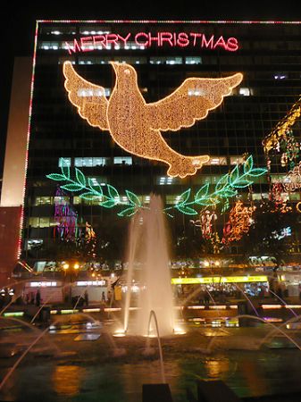
Documenting the guts of the storm at night with my iPhone would have been difficult, I think. You saw the picture of what it was like outside. Inside our local department store, there were a few effects:
Protected from the elements?
But it was a pretty intense experience. The high winds caused our ears to pop when they blew at our building from the right direction. Our poor air conditioner struggled as gale-force winds battered its exhaust vent. Rain pounded against the windows with a vicious insistence. And overnight, the storm intensified according to the observatory. First to a nine:
Which meant "gale or storm force wind is increasing or expected to increase significantly in strength," and then to a 10:
Ten is the second-highest warning they can issue here, and the most recent hoisting of the 10 signal
was in 1999. Officially, it means "Hurricane force wind is expected or blowing with sustained speed reaching upwards from 118 km/h and gusts that may exceed 220 km/h," and practically, it means stay inside and keep your head down. There are a lot of glass-faced buildings in Hong Kong; all of the businesses I passed last night had taped their windows or fixed boards over them.
And I guess it all paid off. Supposedly only about 100 people were injured and no one was killed. This morning the storm was downgraded to an 8, then back to a 3. Now it's just windy. And on the streets, it's business as usual... almost.
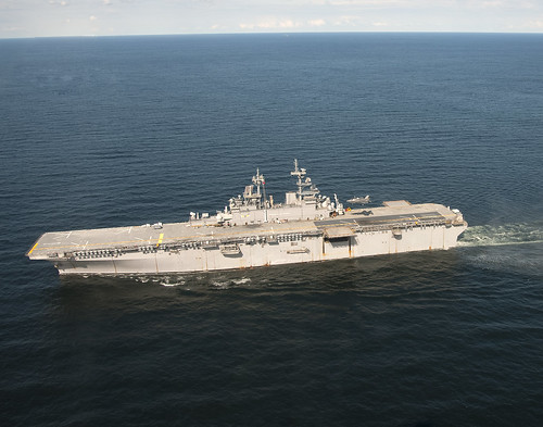
A relatively calm morning... but the PLAN is still parked outside my apartment.
Signs of the storm were everywhere. On the highway exit near our building (which you saw from street level in the first picture I posted), trees sprawled across the road.
Just another commuting obstacle.
On train stop where I get off for work, the crowds to get on the train were so thick they spilled from the platform back into the hallways leading to the platform. Only a few dozen passengers could make it onto each train.
Fortunately I was going the other direction.
On the street, there was detritus everywhere. Remember how I told you my umbrella turned inside out? The sidewalks were a graveyard of umbrella devastation.
Not storm-proof.
Signs had blown down, leaves were strewn about and a lot of businesses were still closed, despite the crowds of commuters.
Some umbrellas didn't even make it to the trash can.
Which direction was the wind blowing last night? Let's ask these trees (the air was calm when I took this picture):
The answer appears to be west.
And that's the story of
Typhoon Vicente, as seen from about 100 kilometers from the storm's center. It has moved on now, passing almost directly over Macao and making landfall at Huangmaohai.
There is only one higher level of typhoon warning, the "10 signal plus black rain." That is not likely to happen while I'm here. But until it does, I can say Mrs. Blog and I made it through the biggest typhoon to hit Hong Kong in more than a decade... and toasted it with margaritas.


.JPG)
.JPG)


.JPG)


